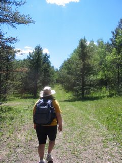
Eventually, the trail we were on ran out, and we came to a sort of faint car track. We checked the GPS and our map, and it seemed to correspond to some dotted lines that would run up to the main road ("Aqueduct Road" on the map), so we took it. At this point, I also remembered that we had brought the camera specifically for blogging purposes, so here are me and Mosch on this car trail:


After a while, this path completely disappeared. Not only did it disappear, but it disappeared while we were scrambling up a very steep slope, moving a few big steps at a time, with much peril. (I'm probably exaggerating, but I am not great at slopes, and I was wearing tennis shoes, not hiking boots, which didn't help.) Mosch pushed on ahead of me and eventually found the road, which was a big relief.
 Aqueduct Road is more or less paved, as you can see here. Reaching it was great because, in my experience, once you reach this road, it's a very quick jaunt home. We had the choice of going left (see the map), which would take us quickly home, or right, which would be a more interesting trip. Mosch urged the fateful rightward turn, so we did that.
I have to confess, I did not look at the map at this point (Mosch did), so in my mind, we only needed to follow this road and it would take us right to the car. In reality, we needed to turn right at the Zoom Trail intersection.
So we continued hiking for quite a while. I was thinking we should be nearly at the car. We had left the car at 1:50, and it was around 4:30, and I had a running bet with Mosch over whether we'd get back closer to 4:40 (my guess) or 5:00 (his guess).
And then the unthinkable happened. We reached the intersection with the Flume Trail. There was a marker for it. I was confused and I looked at the map. I said, "So how can we be here?"
I knew I was wrong, because I usually am when I think we're totally lost or that Mosch is totally wrong about the directions.
But I was not wrong. We had walked past the Zoom Trail by the entire distance to the car from where we should have turned, and our path home was going to be long, long, long.
This was kind of a crisis moment. I was done with walking. Remember I expected to see the car at any moment. (Look at the map to see how laughably wrong I was. We were at the intersection of Aqueduct Road and Flume Trail, which is the southwestern corner of our walk, or just about the furthest point from the car.) Would I freak out? Have a fit? Start crying? Fling myself on the ground and beg to be left for dead?
Tune in to Part 3 to find out...


No comments:
Post a Comment